Leopoldsdorf (2333): location, noise, flood risk and amenities
As of:
Leopoldsdorf (2333) lies in the district of Bruck an der Leitha, Niederösterreich. It had 5,585 residents on 1 January 2026. The centre lies outside mapped flood areas. This overview covers 8 topics from official open data, measured at the centre; values at a specific address can differ.
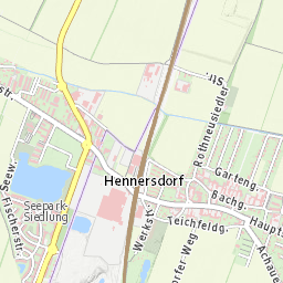
Marker: centre used for this overview, not a specific address.
District
Bruck an der Leitha
State
Niederösterreich
Residents (1 Jan 2026)
5,585
Elevation of the centre
180 m
Contents
Leopoldsdorf (2333): Living in the Southern Vienna Suburbs
Leopoldsdorf is located south of Vienna and combines proximity to the capital with the character of an independent municipality. It is an appealing option for people who want to live outside the immediate urban area without giving up convenient access to everyday amenities. The town centre offers nearby shops, childcare facilities and medical services, while Vienna remains an important destination for work, education and leisure.
A Growing Residential Community
Leopoldsdorf has experienced noticeable growth in recent years. As of 1 January 2026, approximately 5,600 people lived in the municipality, representing an increase of around 17% since 2011. This development reflects the appeal of the southern Vienna suburbs, where residents can combine access to the capital with life in a smaller community.
Leopoldsdorf is neither an isolated village nor simply another Vienna neighbourhood. Instead, established local structures coexist with an increasingly urban lifestyle. Families, commuters and people who value convenient access to everyday services all have reasons to consider living here.
Everyday Convenience and Family Life
One of Leopoldsdorf's advantages is the range of amenities close to its town centre. The nearest kindergarten and primary school are each approximately 100 metres from the centre as the crow flies. A doctor's office and pharmacy are around 150 and 100 metres away, respectively, while the nearest supermarket is approximately 350 metres away.
The wider surrounding area offers even more choice. Within two kilometres of the town centre, the available data records four kindergartens, one school, four supermarkets and grocery stores, six restaurants, one café, two pharmacies and 16 public transport stops.
For families with young children, having childcare and primary education nearby can make daily routines easier. However, families planning for older children should also consider school locations: the nearest lower secondary school is approximately 2.5 kilometres from the town centre.
Getting Around Vienna and the Surrounding Area
Leopoldsdorf benefits from its location in the southern Vienna suburbs. The nearest motorway or expressway is approximately 1.2 kilometres from the town centre, and the B16 main road is at a similar distance.
For rail travellers, Maria Lanzendorf railway station is around 1.8 kilometres from the centre. This means that although rail services may be an option, commuters should factor in the additional journey to the station when planning their daily route.
Quiet Surroundings, Climate and Quality of Life
Noise is another factor worth considering when choosing a home. According to the 2022 strategic noise maps, Leopoldsdorf's town centre lies outside the mapped noise zones for major roads, railway lines, airports and industrial sources. This is a useful indication, but it does not guarantee that every street is quiet. Local traffic and other sources can create significant differences between individual locations.
The local climate is also changing. The average annual temperature around the town centre was approximately 12.4°C between 2015 and 2024, compared with 11.4°C for the 1991–2020 reference period. The area recorded around 34 hot days per year on average.
For anyone buying or renting a home, these figures make practical considerations such as external shading, ventilation and protection against summer heat worth keeping in mind.
According to the available hazard-zone maps, the town centre is also outside the mapped flood zones for HQ100 and HQ300 events. However, anyone considering a specific property should still check its individual location and local conditions.
Who Is Leopoldsdorf Best Suited For?
Leopoldsdorf is worth considering for families and working professionals who want to live south of Vienna while retaining access to everyday amenities and the wider metropolitan area. The short distances to shops, schools and essential services around the centre are a practical advantage.
For people who depend on public transport, the quality of the actual connection matters just as much as the distance to the nearest stop. Ultimately, the experience of living in Leopoldsdorf depends on the specific location and individual needs.
Before moving, consider how easily you can reach work, schools and shopping facilities, how quiet the immediate surroundings are, and whether the daily commute fits your routine. These details will help you decide whether Leopoldsdorf is the right place to call home.
Facts at a glance
Measured at the centre of the place; values at a specific address can differ.
Location of Leopoldsdorf
District
Bruck an der Leitha
State
Niederösterreich
Municipality code (GKZ)
30735
Elevation of the centre
180 m
Leopoldsdorf is a municipality in the district of Bruck an der Leitha, Niederösterreich (postcode 2333, municipality code 30735).
The centre lies at about 180 m above sea level, on level ground.
Building land and zoning
According to the zoning data published by Niederösterreich, the centre is zoned "Bauland-Kerngebiet / mixed use"; nearby there is also other / special zoning and Grünland-Landwirtschaft (agriculture / forestry). Zoning varies across the municipality and is not legally binding here: the Gemeinde's Flächenwidmungsplan and Bebauungsplan apply.
Population
Residents (1 Jan 2026)
5,585
Change since 2011
+16.8 %
Under 15 / 65 and older
14.9 % / 18.1 %
Leopoldsdorf had 5,585 residents on 1 January 2026 (+16.8 % since the 2011 census). 14.9 % are under 15 and 18.1 % are 65 or older.
In the district of Bruck an der Leitha, 19.0 % of 59,829 dwellings have no main residence (second homes and vacant dwellings, 2024).
Residents by citizenship (1 Jan 2026): Austria 86.2 %, Germany 2.5 %, Türkiye 1.8 %, Hungary 1.3 %, Romania 1.2 %, Other 7.0 %. Citizenship is not the same as origin: naturalised residents count as Austrian.
Everyday life and amenities
Within 2 km of the centre of Leopoldsdorf the data list 4 kindergartens, 1 school, 4 supermarkets and groceries, 6 restaurants, 1 café, 1 doctor's practice, 2 pharmacies and 16 public transport stops.
From the centre, the nearest kindergarten about 100 m, the nearest primary school about 100 m, the nearest middle school about 2.5 km, the nearest supermarket about 350 m, the nearest public transport stop about 100 m, the nearest doctor's practice about 150 m and the nearest pharmacy about 100 m away (straight line).
The nearest railway station (Maria Lanzendorf Bahnhof) is about 1.8 km from the centre.
Noise and traffic
The nearest motorway or expressway runs about 1.2 km from the centre. The nearest main road (B16) is about 1.2 km away. The nearest railway line is about 1.3 km from the centre. The nearest airport with scheduled flights is Wien-Schwechat (VIE), about 13 km in a straight line.
The centre lies outside the noise zones of major roads, railways, airports and industry mapped in the strategic noise maps 2022. The maps cover only major traffic routes, so they are an orientation: individual streets in the municipality can be considerably louder or quieter.
Natural hazards
Flood area at the centre
none mapped
Seismic zone
3 / 4
Radon potential class
1 / 3
The centre does not lie in a flood area mapped in the federal hazard zone plans (HQ100 / HQ300). Parts of the municipality can still lie in flood areas, for example along rivers and streams. Smaller streams, surface runoff after heavy rain and groundwater are not included in these maps.
No WLV torrent and avalanche hazard zone plan covers the centre.
Leopoldsdorf lies in seismic zone 3 on a scale of 0 to 4 (ÖNORM B 1998-1).
Radon: potential class 1 of 3; the municipality is not a designated radon area. Actual indoor levels depend on the building; only a measurement gives certainty.
No landslide or rockfall events are documented within 1 km of the centre.
Connections and internet
By public transport from the centre on a weekday morning (from 07:30): about 60 min to St. Pölten Hauptbahnhof (2 transfers), about 30 min to Wien Hauptbahnhof (1 transfer) and about 75 min to Bruck/Leitha Altstadt (2 transfers). The nearest motorway or expressway junction (Leopoldsdorf) is about 1.6 km from the centre.
At the centre, operators report fixed broadband up to 8,192 Mbit/s (FTTH) and mobile networks up to 834 Mbit/s (estimate); availability can differ from street to street. 183 RTR-Netztest measurements within 500 m (2025-10-22 to 2026-10-17) show median download speeds of 85 Mbit/s on fixed lines and 181 Mbit/s on mobile.
Climate and sun
Mean temperature 2015-2024
12.4 °C
Hot days per year
34
Around the centre, the mean annual temperature in 2015-2024 was about 12.4 °C (1991-2020: 11.4 °C). On average there were 34 hot days (≥ 30 °C) and 55 frost days per year, with about 520 mm of precipitation and 14 days with snow cover. About 2,090 hours of sunshine per year.
On 21 December the centre gets about 8:12 h of direct sun (with a flat horizon it would be 8:18 h), on 21 June about 15:42 h. Buildings and trees are not taken into account.
A PV system at optimal tilt yields about 1,190 kWh per kWp and year here (PVGIS).
Frequently asked questions
Is Leopoldsdorf noisy?
The centre lies outside the noise zones of major roads, railways, airports and industry mapped in the strategic noise maps 2022. The nearest motorway or expressway runs about 1.2 km from the centre. The nearest railway line is about 1.3 km from the centre. For your exact address, Place Check creates a separate report with the values at that point.
Is there a flood risk in Leopoldsdorf?
The centre does not lie in a flood area mapped in the federal hazard zone plans (HQ100 / HQ300). Parts of the municipality can still lie in flood areas, for example along rivers and streams. For your exact address, Place Check creates a separate report with the values at that point.
How well is Leopoldsdorf connected to Vienna?
By public transport from the centre on a weekday morning (from 07:30): about 30 min to Wien Hauptbahnhof (1 transfer). The nearest motorway or expressway junction (Leopoldsdorf) is about 1.6 km from the centre. For your exact address, Place Check creates a separate report with the values at that point.
How many people live in Leopoldsdorf?
Leopoldsdorf had 5,585 residents on 1 January 2026, +16.8 % compared with the 2011 census (Statistik Austria). For your exact address, Place Check creates a separate report with the values at that point.
Are there schools and shops in Leopoldsdorf?
Within 2 km of the centre the data list 4 kindergartens, 1 school, 4 supermarkets and groceries, 6 restaurants, 1 café, 1 doctor's practice, 2 pharmacies and 16 public transport stops. For your exact address, Place Check creates a separate report with the values at that point.
How fast is the internet in Leopoldsdorf?
At the centre, operators report fixed broadband up to 8,192 Mbit/s (FTTH) and mobile networks up to 834 Mbit/s (estimate); availability can differ from street to street. 183 RTR-Netztest measurements within 500 m (2025-10-22 to 2026-10-17) show median download speeds of 85 Mbit/s on fixed lines and 181 Mbit/s on mobile. For your exact address, Place Check creates a separate report with the values at that point.
Transitous stop index (MOTIS 2 map/stops) (Transitous (community service); timetable data per transitous.org/sources; Transitous usage policy: non-commercial only (fallback, replace before launch); data per source licences; data 2026-10-22)
Transitous public transport routing (MOTIS 2) (Transitous (community service); timetable data per transitous.org/sources; Transitous usage policy: non-commercial only (fallback, replace before launch); data per source licences, OSM ODbL; data 2026-10-23)
Automatically generated from public data sources, measured at the centre of the place, without warranty. Values at a specific address can differ; this is not a substitute for an expert opinion or the official plans. As of: 22 October 2026. Markdown version